Difference between revisions of "New Austin Frontier"
Tanklovesyou (talk | contribs) |
Tanklovesyou (talk | contribs) |
||
| (5 intermediate revisions by the same user not shown) | |||
| Line 1: | Line 1: | ||
[[Category:Locations]] | [[Category:Locations]] | ||
[[Category:Territories]] | [[Category:Territories]] | ||
| − | <b>New Austin</b> is a frontier territory located in Saint's Crossing. | + | <b>New Austin</b> is a frontier [[territory]] located in Saint's Crossing. |
| Line 9: | Line 9: | ||
|alt = New-austin-birdseye.jpg | |alt = New-austin-birdseye.jpg | ||
|caption = | |caption = | ||
| − | |type = | + | |type = [[Territory]] |
|state = | |state = | ||
|region = [[Cholla Springs]], [[Gaptooth Ridge]], [[Hennigan's Stead]], [[Río Bravo]] | |region = [[Cholla Springs]], [[Gaptooth Ridge]], [[Hennigan's Stead]], [[Río Bravo]] | ||
| Line 36: | Line 36: | ||
The following is an alphabetical list of the locations found in New Austin: | The following is an alphabetical list of the locations found in New Austin: | ||
| − | |||
<h5>Hennigan's Stead</h5> | <h5>Hennigan's Stead</h5> | ||
| Line 80: | Line 79: | ||
<h5>Gaptooth Ridge</h5> | <h5>Gaptooth Ridge</h5> | ||
| − | |||
*[[Cueva Seca]] | *[[Cueva Seca]] | ||
*[[Gaptooth Breach]] | *[[Gaptooth Breach]] | ||
| Line 94: | Line 92: | ||
*[[Benedict Pass]] | *[[Benedict Pass]] | ||
| + | *[[Benedict Point]] | ||
*[[Río del Lobo Rock]] | *[[Río del Lobo Rock]] | ||
*[[Fort Mercer]] | *[[Fort Mercer]] | ||
Latest revision as of 22:34, 11 August 2022
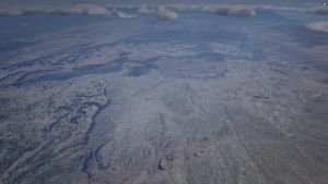
New Austin is a frontier territory located in Saint's Crossing.
Description
The New Austin Frontier is a largely rugged and arid desert in the process of westward expansion. As such, there is an expected presence of wild animals and outlaws. Armadillo and Tumbleweed are the main settlements of the territory, although it is generally fairly rural. It is second only to Ambarino as the most sparsely populated region.
Major industries in New Austin include farming, ranching, oil, and transportation. The State has attracted some immigrants (domestic and foreign) to work on the railways and other developments occurring. New Austin also acts as a key region between US and Mexico trade. There are hints of the territory's previous Spanish/Mexican heritage, in terms of place names and architecture.
Geography
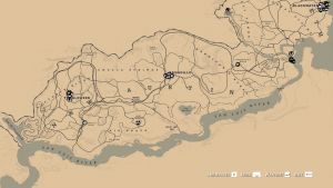
New Austin lies between Nuevo Paraíso to the south and West Elizabeth to the northeast. It comprises four regions: Cholla Springs, Gaptooth Ridge, Hennigan's Stead, and Río Bravo.
South of New Austin is the San Luis River, which acts as a natural border to Nuevo Paraíso. New Austin is also bordered to the east by Flat Iron Lake, which leads to the Lannahechee River and gives New Austin key water links to the rest of the United States. New Austin is bordered to the north by the Redemption Mountains, while the Sea of Coronado and more mountains border it to the west, giving the region a greater feeling of isolation and remoteness.
Locations
The following is an alphabetical list of the locations found in New Austin:
Hennigan's Stead
- Brittlebrush Trawl
- Dixon Crossing
- Greenhollow
- MacFarlane's Ranch
- Manteca Falls
- Mason's Bridge
- Mescalero
- Montana Ford
- The Old Bacchus Place
- Pike's Basin
- Stillwater Creek
- Thieves' Landing
- Tree House
Cholla Springs
- Armadillo
- Coot's Chapel
- Critchley's Ranch
- Crashed Airship
- Donkey Lady
- Hamlin's Passing
- The Hanging Rock
- Jorge's Gap
- Lake Don Julio
- Mercer Station
- Oddfellow's Rest
- Pleasance House
- Rattlesnake Hollow
- Ridgewood Farm
- Río del Lobo
- Riley's Charge
- Twin Rocks
- Two Crows
- Venter's Place
Gaptooth Ridge
- Cueva Seca
- Gaptooth Breach
- Rathskeller Fork
- Sea of Coronado
- The Scratching Post
- Silent Stead
- Solomon's Folly
- Tumbleweed

